
September 17, 2026
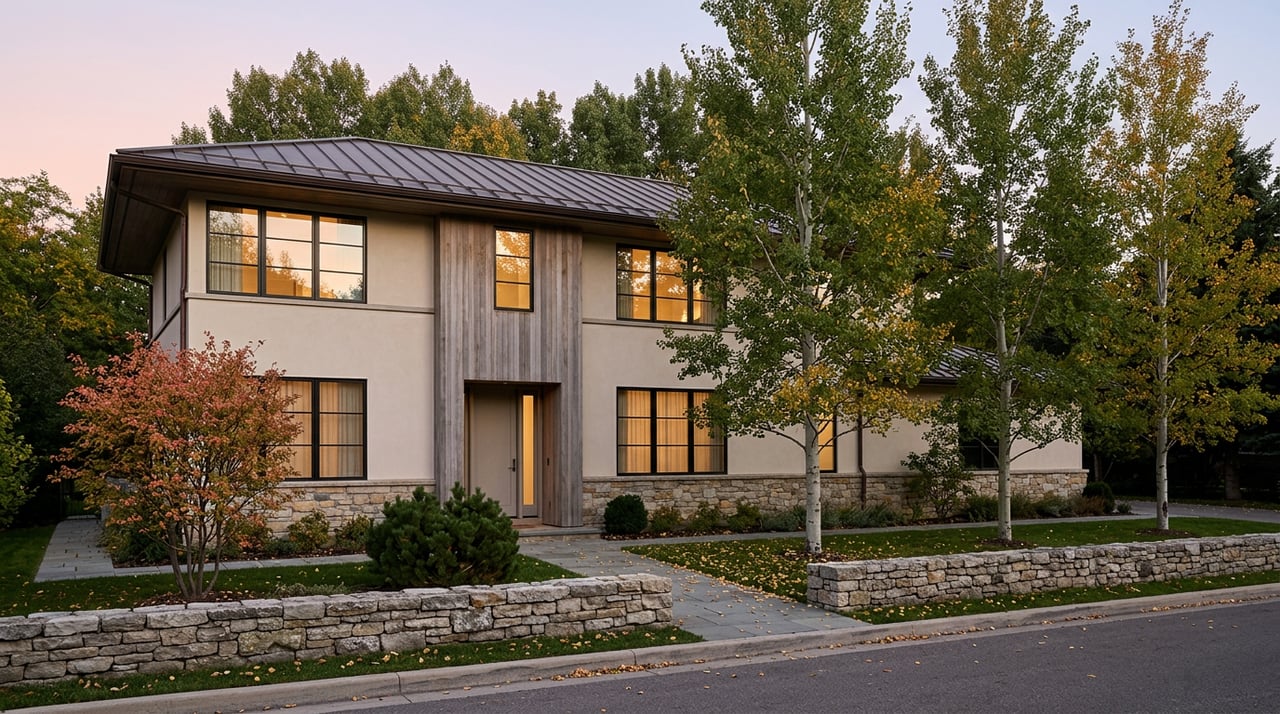
Two things are true about Aspen's West End in the fall of 2026, and neither one has anything to do with the other. A hospitality brand best known for its Nantucket and Palm Beach hotels opened its first property west of Nantucket on the corner of Main and Garmisch. And eight blocks away, city engineers are still counting cars on Power Plant Road with cameras that didn't exist two years ago.
Neither story caused the other. But put them side by side and you get something more useful than either headline alone: this is the first year the West End has been measured and marketed in the same twelve months. One arrival, one instrument. Together they tell you more about what it's actually like to live here right now than either does on its own.
White Elephant Aspen opened for reservations in February 2026, a 54-room hotel at 110 West Main Street designed by the Boston firm EMBARC, close enough to the Aspen Institute, Harris Hall, and the Benedict Music Tent that a guest could walk to all three before finishing a cup of coffee.
The hotel's restaurant, Lola 41, opened officially on June 15. It's the fifth Lola Hospitality location and the second one built inside a White Elephant property, following a template the brand has run since its original Nantucket restaurant opened in 2006. The Aspen menu leans into seafood and sushi with Mediterranean and Asian influences, built around the concept that gives the restaurant its name: the countries and regions that sit near the 41st parallel. There's a 42-seat dining room and bar, a 60-seat outdoor patio, and a hidden 12-seat lower level called 41 Below, a private room the hotel positions for occasions like a milestone birthday or a closing dinner.
General manager Kelly O'Neill told the Aspen Times the restaurant has filled up every night since opening, faster than the team expected. That's a hospitality anecdote, but it's also a small data point about what's changed on that corner: a neighborhood that has always had the Aspen Institute and the Music Tent as its cultural anchors now has a restaurant patio that's genuinely hard to book on a Friday night, sitting on a residential-adjacent stretch of Main Street that, until February, was mostly known for slow traffic.
The West End's other 2026 story started with a number nobody had until recently. For decades, residents have described a pattern locally known as the "West End sneak": drivers leaving Aspen during peak hours, frustrated by backups on Highway 82, cutting through West Smuggler Street to Power Plant Road to bypass the gridlock and reconnect with the highway near Cemetery Lane. It's not a new complaint. What's new is that the city can finally put a number on it.
Until 2024, Aspen had exactly one continuous traffic counter, positioned on Highway 82 between the Castle Creek Bridge and Cemetery Lane. Everything happening on the neighborhood's own streets was anecdotal. In late 2024 and early 2025, the Elected Officials Transportation Committee installed seven new counters, including ones on Power Plant Road, McLain Flats Road, Owl Creek Road, and Maroon Creek Road, and replaced the aging Castle Creek unit with an AI-powered camera system that can distinguish passenger cars from delivery trucks.
The first full year of that data landed in 2025, and it settled an argument that had been running on anecdote alone. McLain Flats Road averaged 2,408 vehicles a day in 2025, peaking at 5,783 on June 12. Combined with Power Plant Road counts, the numbers back up a figure Aspen Mayor Rachael Richards cited at the December 2, 2025 city council meeting: roughly 34 percent of the traffic that enters Aspen each day exits through the West End and Power Plant Road, not back out through the highway. That's not a rounding error. That's a third of the city's daily exit traffic routed through streets that were built for a residential neighborhood, not a bypass.
That same December 2 meeting is where the number turned into money. City council approved $397,000 in contracts with two firms, Alta Planning + Design and Jacobs, to study and design mitigation across a defined 12-task scope. The boundaries staff used to define the project area are specific: east of 8th Street, south of Gillespie Avenue, west of Mill Street, and north of Main Street, which is to say, essentially the whole historic grid.
By late spring 2026, the work had produced findings, not yet fixes.
| What's being studied | Where | Status as of spring/summer 2026 |
|---|---|---|
| Pedestrian walkways | 7th and 8th Streets, connecting the 8th Street bus stop to the Aspen Meadows campus | Alta evaluating alternatives, not yet built |
| Curb extensions | 7th/Smuggler and 8th/Smuggler intersections | Under design following completed survey |
| One-way alley conversions | Neighborhood-wide | Resident survey showed limited support; a one-way sign was added on the North Street alley in fall 2025 by request |
| Signal timing | Cemetery Lane and Truscott lights, with CDOT | Jacobs analysis underway to reduce cut-through incentive |
| Weight or length restrictions | Power Plant Road | Vehicle class data collected, legal authority under review |
| Turn restriction | Mill Street onto East Bleeker Street | Traffic study model in development |
| Noise enforcement | Neighborhood-wide, including camera-based systems | Research phase, with noise data collection planned for July |
None of this has closed a road or installed a stop sign yet. A city staff update in May 2026 was explicit that the purpose was to set expectations, not announce completed fixes, and that some items still need peak-season data before returning to council for direction. If you live on Smuggler or one of the cross streets, the honest read is that 2026 is the year the problem got a budget and a methodology, not the year it got solved.
While the long-range engineering work continues, one piece of the response is already running on the street. The Aspen Police Department first ran a dedicated West End traffic enforcement pilot from August 25 through October 30, 2025, assigning an officer to focus solely on education and enforcement in the neighborhood. Over that stretch, officers made 357 traffic stops, 251 of them inside the West End, resulting in 168 citations, most commonly for speeding and stop sign violations.
Police Chief Kim Ferber called the results significant enough to justify a repeat, and in June 2026 the department announced it would continue the pilot through the summer season. As Ferber put it in the department's release, the goal isn't simply to write tickets:
"Our goal is not simply to issue citations, but to encourage safer driving behaviors, increase awareness of traffic laws, and help create safer streets for everyone, whether they are walking, biking, driving, or rolling through our community."
So the practical texture of a West End afternoon in 2026 looks like this: a dedicated officer working the neighborhood's residential streets on a returning pilot program, layered over a multi-firm engineering study that's still collecting data before it recommends anything permanent. Slower, more visible enforcement now. Structural change later, if it comes at all.
Here's the thing worth sitting with. The same year a five-star hospitality brand decided the corner of Main and Garmisch was worth its first Colorado bet, the city finally got the instrumentation to prove what West End residents had been saying for years about their own streets. Those two facts don't cancel each other out and they don't explain each other. They're just both true, and together they describe a neighborhood getting more attention from two completely different directions at once: one measuring it in vehicle counts, the other measuring it in restaurant covers.
If you're showing out-of-town guests around this fall, the Aspen Historical Society still runs its Victorian West End Walking Tour on Thursdays and Saturdays at 10:30 a.m., starting at the Wheeler/Stallard Museum on West Bleeker Street. The guides cover the neighborhood's Ute history, its former racetrack and rodeo grounds, and the Victorian and midcentury homes that make the preservation rules here different from anywhere else in town. It's a good way to explain to a first-time visitor why these particular streets, the same ones showing up in traffic camera data, were never built to carry the volume they carry now.
That contradiction, tree-lined and historic on one hand, quietly overloaded on the other, is the real shape of the West End in 2026. It's worth knowing both halves before you decide what the neighborhood is actually like to live in.
For a longer conversation about how the West End's traffic study, its new arrivals, or any of Aspen's other neighborhoods are shaping the market this year, Stephanie Lewis is available to book a private consultation.
Stay up to date on the latest real estate trends.
She is enthusiastic, hardworking, discreet and is intimately familiar with the local real estate market. She has worked with a wide range of American and International clientele, spanning the world of finance, media, entertainment and real estate.